Sunday, September 15, 2024 | St. Lawrence County, NY
The National Weather Service has released a comprehensive report following the dramatic flooding seen across St. Lawrence County on Aug. 9, detailing the amount of rainfall in the aftermath …
This item is available in full to subscribers.
To continue reading, you will need to either log in to your subscriber account, or purchase a new subscription.
If you are a digital subscriber with an active, online-only subscription then you already have an account here. Just reset your password if you've not yet logged in to your account on this new site.
Otherwise, click here to view your options for subscribing.
Please log in to continue |
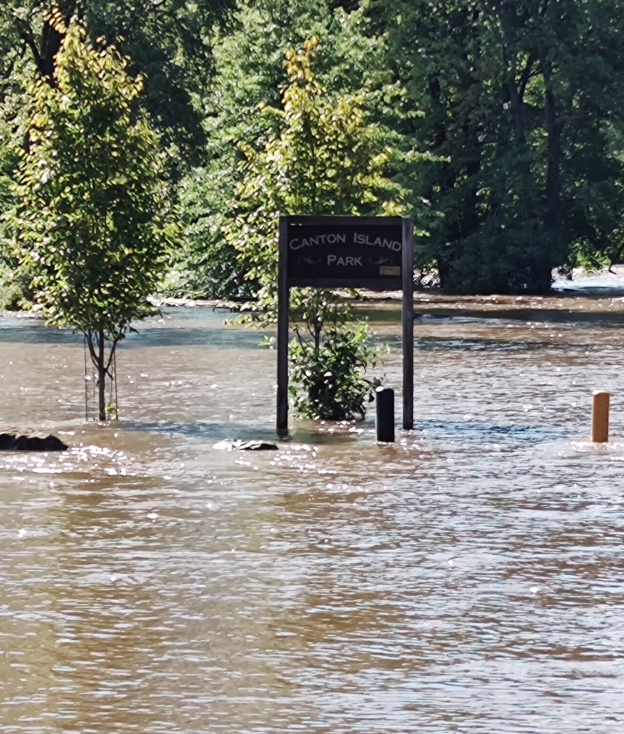
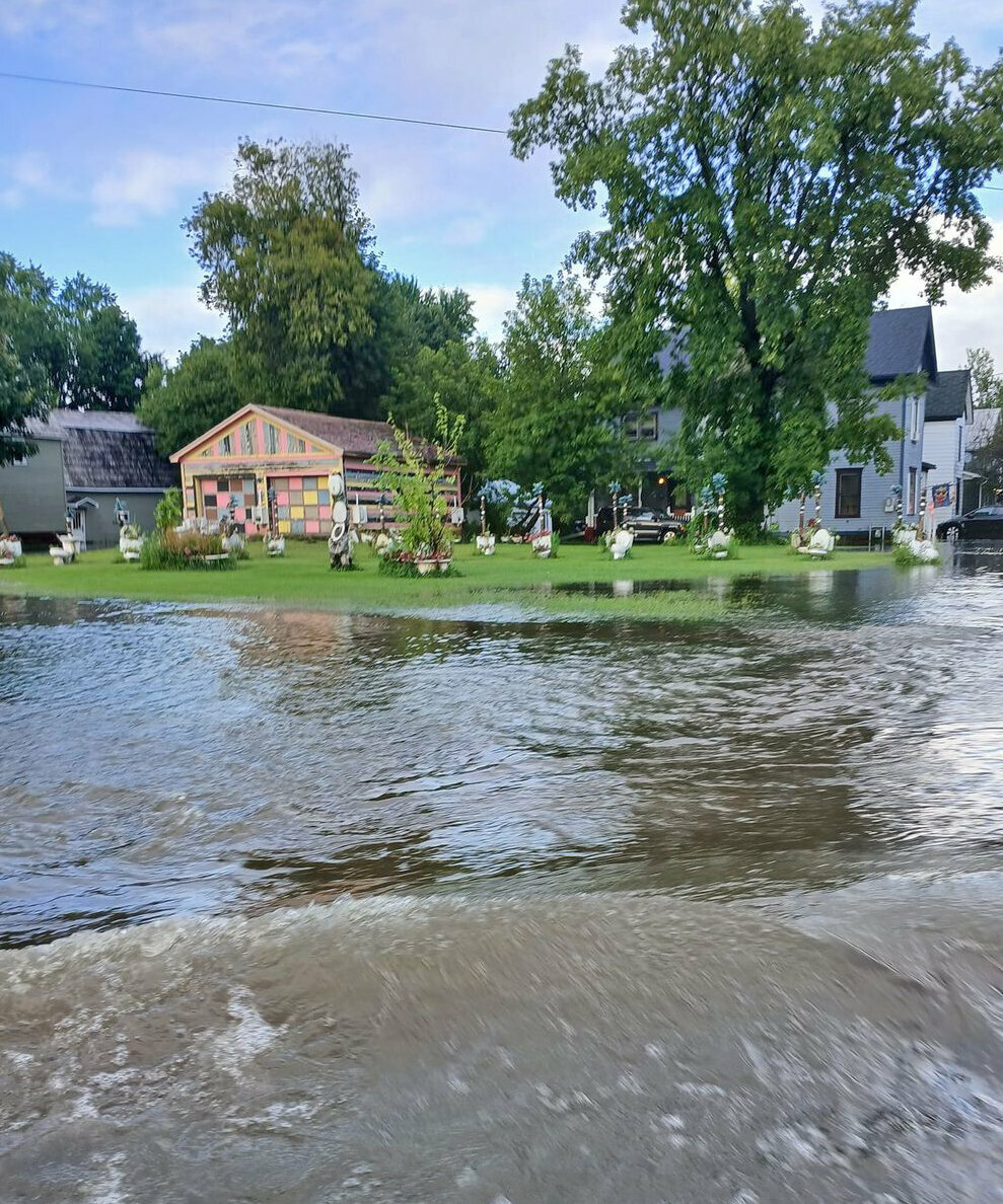
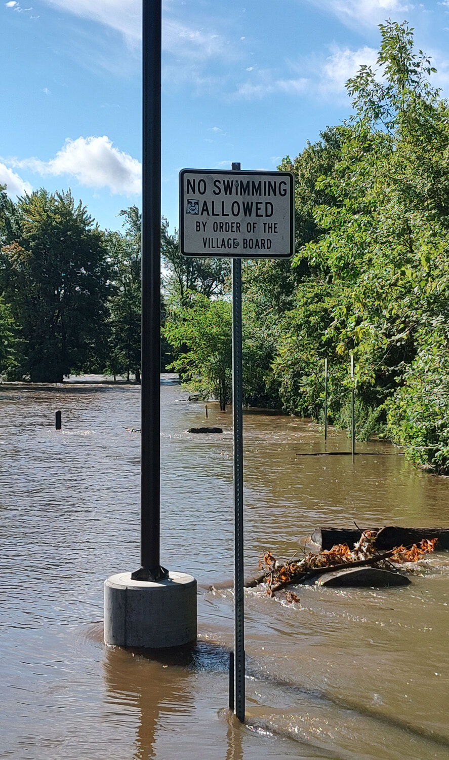
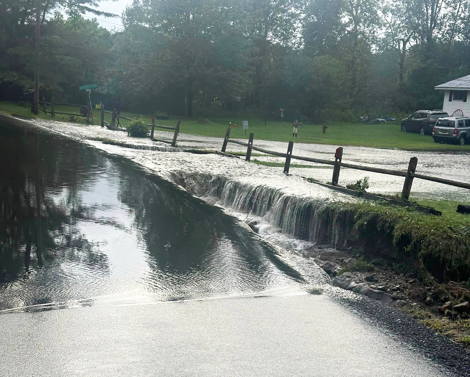
The National Weather Service has released a comprehensive report following the dramatic flooding seen across St. Lawrence County on Aug. 9, detailing the amount of rainfall in the aftermath of Hurricane Debby.
According to the NWS, some areas throughout the county saw in excess of seven inches of total rainfall, including areas near Colton, South Colton and Fowler.
"One aspect of this event was the impressive rainfall rates observed in the core of the heaviest precipitation swath. Within this band, precipitable water (PWAT) values, or the amount of water held in the atmospheric water column, ranged from 2.1 to 2.4 inches. These values approached record levels for the date as interpreted by the NOAA/NWS Storm Prediction Center's Atmospheric Sounding Archive, using Albany, NY as a closest proxy," the NWS said in the report.
On average, rainfall throughout the county was over 2" per hour at the peak of the storm, according to the NWS.
According to the report, a 50 to 70 mile swatch of excessive rainfall struck the county and northwestern Franklin County, leading to a much higher average rainfall total that peaked at 7.35" in North Lawrence.
North Emeryville was also hit hard, with 7.1" of total rainfall.
Norwood saw 6.6" in total rainfall, with Hermon not far behind with 6.49"
Potsdam was struck with 4.91" total, while Canton saw 3.86", according to the NWS.
Massena saw 4.25" of rainfall, while Gouverneur saw 3.92" total.
Rain drop size was also a key feature of the report, with the NWS saying that the rain seen on Aug. 9 resembled what is more common in tropical air masses around the world, as opposed to a standard continental rainfall typically seen in the North Country.
"Another feature observed in this band, and one that is common in tropical air masses around the world, is an atmospheric phenomenon known as warm rain processes. Under these conditions, the distribution of rainfall drop size is focused toward a larger percentage of smaller drops as opposed to a more uniform mix of large and small drops in standard continental rainfall (i.e. a standard thunderstorm in the summer)," the NWS reported.
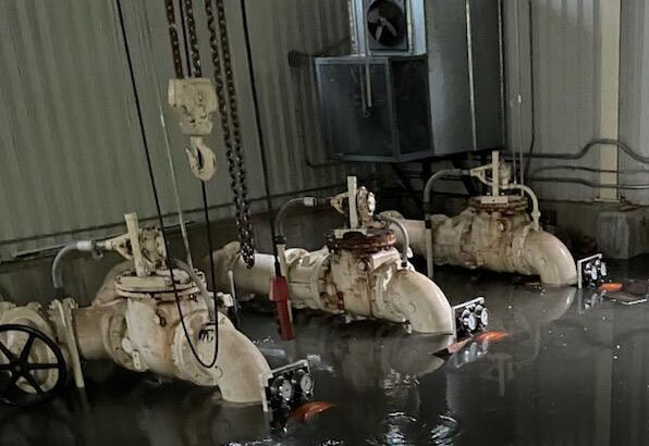
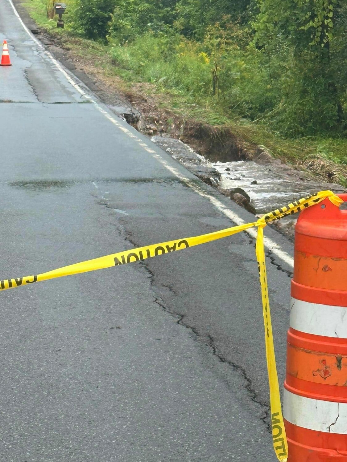
Flooding throughout the county damaged over 100 highways, bridges and culverts that are currently undergoing assessment and repairs. Detours have been established for those most affected as well.
County Highway Superintendent Don Chambers recently detailed the damage with county legislators, saying the cost of repairs will total well into the millions of dollars.
Legislators passed a resolution during the Aug. 26 Finance Committee meeting, authorizing $650,000 for emergency road and structure repairs to reopen all affected roads.
“It’s going to likely be into the several million dollars to complete repairs even though we have, for example, some bridges that have already been replaced or had extensive repairs,” he said.
Chambers said the $650,000 the resolution approved spending is just for emergency repairs to ensure “roads are safe to the traveling public.”
He said some structures, like culverts, would require improvements to a standard set by the Department of Environmental Conservation (DEC) following an assessment after the storm.
Chambers said larger culverts and significant road repairs were needed around the county but said it was his hope the state and federal government would help financially.
“Hopefully what we’ll see is some help from the state and federal government to address these final needs, but I just wanted to be clear this is for getting the emergency repairs done,” he said.
That help will hopefully be on the way soon after President Joe Biden signed off on federal disaster relief for the county.
The news broke Aug. 29 as President Joe Biden signed off on the Major Disaster Declaration to provide federal assistance to the affected communities.
Governor Kathy Hochul also announced the support, saying the federal financial assistance would support public infrastructure reconstruction efforts throughout multiple counties, including St. Lawrence County.
Though the funds are being distributed for storm damage related to Hurricane Beryl on July 10 and 11, Chambers said the county has met the FEMA standard to qualify for federal aid stemming from the Aug. 9 flooding as well.
Southern St. Lawrence County was affected by the July 10 and 11 storm, leading to the Major Disaster Declaration from the federal government.
Chambers said larger culverts and significant road repairs were needed around the county but said it was his hope the state and federal government would help financially.
“Hopefully what we’ll see is some help from the state and federal government to address these final needs, but I just wanted to be clear this is for getting the emergency repairs done,” he said.


